
Faith Muni, SD Climate: Temperature & Rain by Month
Pulled from NOAA NCEI 1991–2020 normals →: climate measurements used in PlainClimate's documented score
30-year climate normals (1991-2020) from Faith Muni's primary NOAA station, FAITH MUNI AP.
The climate verdict for Faith Muni
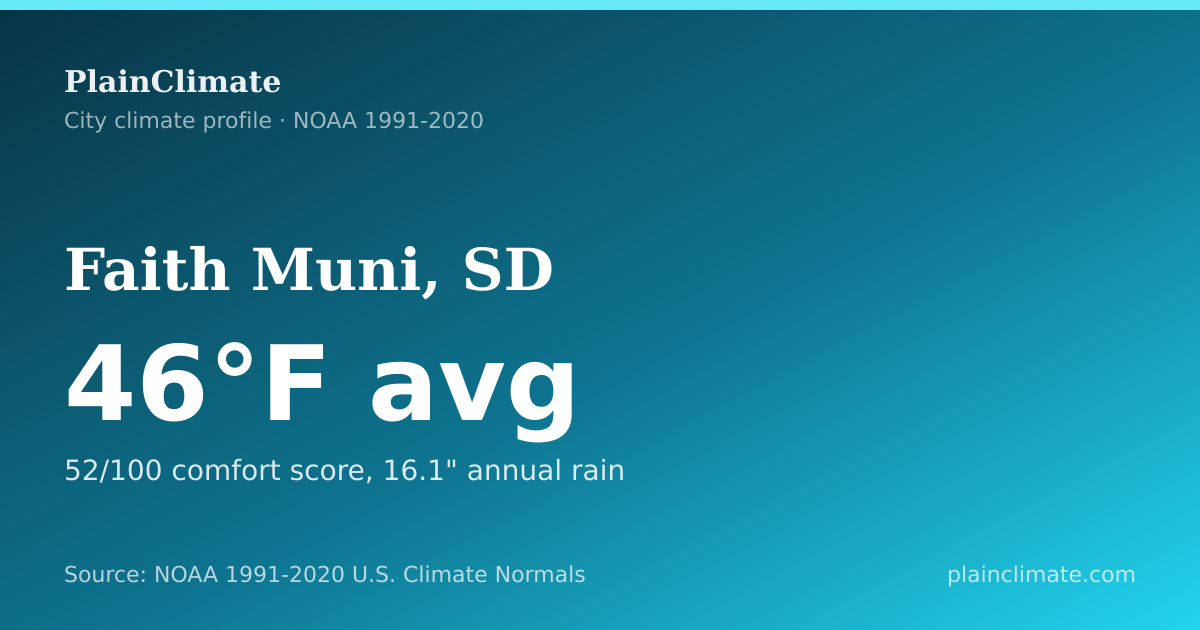
Dryness leads the climate profile for Faith Muni, South Dakota, with 16.1 inches of precipitation a year. NOAA records an annual average of 46°F. At 52/100 (moderate) the climate comfort score falls in the bottom third of the station-mapped U.S. score corpus, exceeding only 24% of scores.
- 46°F
- annual average temperature (NOAA normal)
- 52/100
- comfort score, above 24% of station-mapped location scores
- 16.1"
- precipitation, annual total
- 149 days
- frost-free days per growing season
Faith Muni: NOAA 1991-2020 normals describe a typical year, not a forecast. Method: /methodology.
Normals record plate
Sheet USW00094056 · Faith Muni, SD 46°F mean · 16.1" precip
TEMP-COOL · RANK-COOL · PHOTO-FINISH · PRCP-DRY · SWING-WIDE · COMF-LOW · LOAD-HEAT · STN-1 · BOOK-FULL
- TEMP-COOL 46°F
- RANK-COOL #1,509
- PHOTO-FINISH ≈ Lemmon
- PRCP-DRY 16.1"
- SWING-WIDE 53°F
- COMF-LOW 52/100
- LOAD-HEAT 7,631 HDD
- STN-1 USW00094056
- BOOK-FULL 6/6 fields
Nearest mean-temperature peer: Lemmon, SD ( -0.1 °F mean)
Instrument codes from this station's NOAA 1991–2020 normals, mean temperature, corpus warmth rank, photo-finish peer station, precipitation band, seasonal swing, comfort composite, degree-day load, and field book, not a livability rating.
Mean-temperature neighbourhood
Nationwide NOAA normal poles and nearest peers, not a reprint of every SD station list.
- Faith (this station) 46°F
- Cold Lemmon, SD 46°F
- Hot Wentworth, SD 46°F
- Near Farmington, MN 46°F
- Near Bison, SD 46°F
Climate Living Index · Faith Muni
Faith Muni: 26/100 · grade F
Faith Muni publishes 4 of 6 Living Index dimensions (NOAA annual/seasonal normals · NOAA daily multivariate normals); 2 missing weights rescale to 100.
PlainClimate-derived for Faith Muni, not an official NOAA rating. Rankings still use Comfort Score 52/100 (separate formula). Breakpoints and limits.
| Dimension | Station value | Score |
|---|---|---|
| Precipitation balance | 16.1 in · 18.9 from 35 in | 32/100 · F |
| Normal heat + freeze calendar | 177 calendar days | 27/100 · F |
| Frost-free season | 149 days/year | 24/100 · F |
| Annual temperature balance | 45.8°F · 21.7° from 67.5°F | 22/100 · F |
Faith Muni · 2026-08-04 · NOAA NCEI Climate Normals · method · Comfort Score method.
Faith Muni's normals sit in a dry climate class: BSk
Precipitation is low relative to temperature but above true desert thresholds: cold semi-arid steppe (BSk). Class BSk is the Peel et al. (2007) label for this station's monthly mean temperature and precipitation normals: dry (arid or semi-arid), specifically cold semi-arid steppe.
- Köppen code
- BSk
- Group
- Dry (arid or semi-arid)
- Warmest month
- 73.0°F
- Coldest month
- 19.6°F
Source: official public datasets monthly normals (1991–2020) at the city’s primary station. This is a station classification, not a mapped regional consensus.
National standing · heating-led station
Where Faith Muni sits across the climate record
Three NOAA fields for Faith Muni's primary station, temperature, precipitation, and seasonal swing, are ranked against every station-mapped normal that carries the same field.
- Annual temperature
- Cooler than 78%
- Among 6,861 stations, Faith Muni sits in the cooler third of annual means.
- Annual precipitation
- Drier than 80%
- Faith Muni's annual total ranks in the drier third of 6,352 measured normals.
- Seasonal temperature swing
- Wider than 89%
- Warmest-to-coldest month gap for Faith Muni is large versus 6,861 complete station-years.
How Faith Muni compares across U.S. station-mapped locations
Faith Muni's comfort score vs. all station-mapped locations
PlainClimate composite comfort index (1–100), NOAA 1991–2020 normals
52 24th percentile score exceeds 24% of 6,189 station-mapped location scores
- 0–10: 0 station-mapped locations (0%). Below this entry.
- 10–20: 0 station-mapped locations (0%). Below this entry.
- 20–30: 96 station-mapped locations (2%). Below this entry.
- 30–40: 280 station-mapped locations (5%). Below this entry.
- 40–50: 1,113 station-mapped locations (18%). Below this entry.
- 50–60: 1,329 station-mapped locations (21%). This entry sits in this band.
- 60–70: 1,236 station-mapped locations (20%). Above this entry.
- 70–80: 650 station-mapped locations (11%). Above this entry.
- 80–90: 921 station-mapped locations (15%). Above this entry.
- 90–100: 564 station-mapped locations (9%). Above this entry.
Source NOAA U.S. Climate Normals, PlainClimate comfort index · 1991–2020
Monthly Temperatures
Average daily high and low temperatures by month
| Month | Avg High | Avg Low | Mean | Precip | Freeze Days | 90°F+ Days |
|---|---|---|---|---|---|---|
| January | 29°F (-1°C) | 10°F (-12°C) | 20°F (-7°C) | 0.4" | 30.1 | 0.0 |
| February | 33°F (0°C) | 13°F (-11°C) | 23°F (-5°C) | 0.5" | 27.1 | 0.0 |
| March | 44°F (7°C) | 22°F (-5°C) | 33°F (1°C) | 0.7" | 26.3 | 0.0 |
| April | 56°F (14°C) | 32°F (0°C) | 44°F (7°C) | 1.8" | 14.7 | 0.0 |
| May | 67°F (19°C) | 43°F (6°C) | 55°F (13°C) | 3.2" | 3.0 | 0.4 |
| June | 78°F (25°C) | 53°F (12°C) | 65°F (19°C) | 2.7" | 0.0 | 3.1 |
| July | 87°F (30°C) | 59°F (15°C) | 73°F (23°C) | 2.1" | 0.0 | 13.1 |
| August | 85°F (30°C) | 58°F (14°C) | 71°F (22°C) | 1.4" | 0.0 | 10.3 |
| September | 76°F (24°C) | 48°F (9°C) | 62°F (17°C) | 1.2" | 0.7 | 3.7 |
| October | 59°F (15°C) | 35°F (1°C) | 47°F (8°C) | 1.4" | 12.0 | 0.1 |
| November | 44°F (7°C) | 23°F (-5°C) | 33°F (1°C) | 0.4" | 24.3 | 0.0 |
| December | 32°F (0°C) | 13°F (-10°C) | 23°F (-5°C) | 0.4" | 30.1 | 0.0 |
The year, day by day
Summer here tops out rather than builds: the warmest normal high is 88°F around July 22, short of 90°F on every date, while 177 dates carry a normal low at or below freezing, the coldest 10°F near January 18.
The freezing stretch
The normal low stays at or below 32°F into April 15, then returns to freezing around October 22, covering 177 dates in all.
Derived from the normal daily minimum. This is a different measure from the 50%-probability frost dates shown elsewhere on this page, which come from NOAA’s frost product.
Where the wet dates fall
The likeliest wet date is June 2, when 42% of years recorded at least a hundredth of an inch. The driest is November 21 at 16%. Summed across the calendar, that is about 97 wet dates a year.
The widest day
September 4 carries the biggest normal gap between afternoon and dawn, 28°F between the normal high and the normal low.
Look up any date
Any date's 1991–2020 normal for Faith Muni.
Monthly Precipitation
Average monthly rainfall
6.9 days with precipitation
7.7 days with precipitation
7.3 days with precipitation
9.3 days with precipitation
11.8 days with precipitation
12.0 days with precipitation
8.4 days with precipitation
7.7 days with precipitation
6.8 days with precipitation
7.5 days with precipitation
4.8 days with precipitation
6.2 days with precipitation
Faith Muni runs a summer-peaked wet season
39% of Faith Muni's yearly precipitation falls in June, July and August alone, against the 25% an evenly spread year would give those three months. The wettest month is May at 3.2", on a wide 53.4°F gap between its warmest and coldest month. Warm-season convection and, across the Southwest, the North American monsoon produce this shape: rain arrives in short heavy bursts during the hottest part of the year rather than as long cool-season soaking.
- Wettest three months: May, June, July, taking 50% of the annual total between them.
- Driest month: November at 0.4".
- Winter share: 8% falls in December, January and February.
Shares are computed from this station's own 1991-2020 monthly precipitation normals. A summer-peaked label means the June-August share reaches 35%; it describes timing across an average year, not any single season, and says nothing about how heavy an individual storm can be.
Faith Muni is dry, and what does fall arrives gently
Only about 96 days a year record measurable precipitation here, 26% of the calendar, and they carry 16.1" between them. At roughly 0.17 inches on an average wet day, this is not the damp drizzle of a marine climate; it is an arid record in which precipitation is both uncommon and light when it appears.
The wettest month by count is June at about 12 wet days; the driest is November at about 5.
A low per-event average in a dry record is a statement about typical days only. Arid regions can still take a large share of a year's total from a single convective storm, which a normal cannot show.
A wet day is one recording at least 0.01 inches. These are 1991-2020 normals: they describe an average year, not the extremes within it.
Frost Dates & Growing Season
First Fall Freeze
October 3
50% probability date
Last Spring Freeze
May 7
50% probability date
Growing Season
149 days
Heating & Cooling Degree Days
Annual totals indicate energy demand for heating and cooling
Heating Degree Days
7,631
Higher = more heating needed
Cooling Degree Days
657
Higher = more cooling needed
Warmest Month
July
Coldest Month
January
Nationwide similar cities
Other rankable U.S. places outside SD closest to Faith Muni on two NOAA annual-normal axes (mean temperature and annual precipitation). Chip rows use distinct link sets.
Closest by average temperature
Nearest out-of-state peers by annual mean temperature (46°F here).
- Angelica, NY 46°F · 0.0°F off
- Cass City, MI 46°F · 0.0°F off
- Flaming Gorge, UT 46°F · 0.0°F off
- Gardiner, ME 46°F · 0.0°F off
Closest by annual precipitation
Nearest out-of-state peers by annual precipitation (16.1" here), excluding temperature-peer places.
- Crosby, ND 16.1" · 0.0" off
- Kim, CO 16.1" · 0.0" off
- Portales, NM 16.1" · 0.0" off
- Tremonton, UT 16.1" · 0.0" off
Data-derived climate profile
How Faith Muni's climate pattern fits together
heating led · dry · mid swing
Faith Muni's energy balance leans toward cold weather: 7,631 annual heating degree days against 657 for cooling. Its 53.4°F seasonal range still makes the monthly rows more useful than the annual average alone.
Only about 149 days are frost-free in a normal year. That short interval is consistent with the cold-season signal, but the measure does not predict the exact first or last freeze in any one year.
July and January mark the typical warm and cold ends of the calendar in Faith Muni's middle-range seasonal profile. The measured spread is 53.4°F. The annual average is 46°F. Neither the annual mean nor one extreme month represents the full calendar on its own.
Faith Muni's cold-season load does not imply a wet climate. Annual precipitation is 16.1 inches, which places the station in PlainClimate's dry range. Snowfall is not added to the interpretation because its annual value is missing. The snowfall and rainfall fields should be read separately rather than inferred from temperature.
These labels group NOAA 1991-2020 normals from Faith Muni's primary station, so the winter figures are a thirty-year average and not a floor: a single hard season can run well below them. Treat each band as a descriptive range for Faith Muni, not an official NOAA class or a year-ahead forecast.
Questions about Faith Muni's climate
How much rain does Faith Muni get? ▼
How many days above 90°F does Faith Muni get? ▼
How much energy does heating and cooling require in Faith Muni? ▼
Data Sources
Data source: NOAA U.S. Climate Normals v1.0.1 (1991-2020). All figures on this page are from Faith Muni's primary station: FAITH MUNI AP (USW00094056). For informational purposes only.
Place identity: U.S. Census Bureau 2024 Gazetteer places. The conservative exact name-and-state crosswalk finds no Census place match, so PlainClimate treats this as a station-mapped location and does not claim it is a municipality. No exact Gazetteer row for Faith Muni; facility counts that depend on place identity are therefore an upper bound, not a municipal census.
On this page every temperature, precipitation, and derived score for Faith Muni comes from its primary NOAA station record. No figure on this page is typed in by an editor - each value is rendered from NOAA 1991-2020 U.S. Climate Normals. See our editorial standards & corrections policy, the methodology behind these numbers, or report a data error. Data current as of 1991–2020 normals.